|
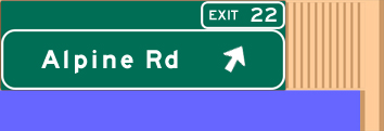
Exit
22 |
 South South |
Alpine Road provides access to Stanford
University, the upscale Stanford Shopping Center and the city
of Menlo Park. Alpine also heads into the Santa Cruz Mountains
to Portola Valley. |
|
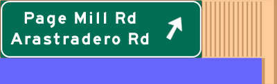
| Exit
20 |
South |
Page Mill Road is one of Palo Alto's
major roads. A number of tech companies including Hewlett Packard
are located on Page Mill. This exit can also be used to get to
Stanford University. |
|
| Exit
16 |
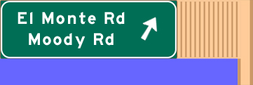
South |
Foothill College is located off of El
Monte Road west of Interstate 280. This is best exit for getting
to downtown Los Altos. |
|
| Exit
15 |
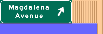
South |
Magdalena Avenue provides freeway access
for residents living in the foothills of Los Altos, Los Altos Hills
and Cupertino. |
 |
| Exit
13 |
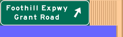
South |
Foothill Expwy is part of the county's
expressway system and it basically parallels Interstate 280 from
Cupertino to Palo Alto passing through Los Altos. It is an important
commuter route for those working for companies located in Palo
Alto.
After this exit, you'll notice a dramatic
change in terrain as you leave the scenic foothills of the Santa
Cruz Mountains and enter the flat, urban part of Silicon Valley. |
 |
| Exit
12B |
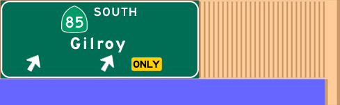
South |
Southbound Hwy 85/Stevens Creek Freeway
serves the communities of the western and southern parts of Silicon
Valley. Use this exit to get to De Anza College in Cupertino. |
 |
| Exit
12A |
South |
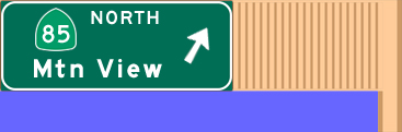
Northbound Hwy 85/Stevens Creek Freeway
heads into Sunnyvale and Mountain View before merging onto U.S.
101 near Moffett Field. |
 |
| Exit
11 |
South |
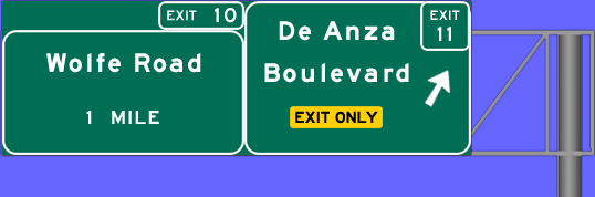
De Anza Blvd is a major north-south road
through Cupertino with Sunnyvale to the north and Saratoga to the
south. The world headquarters for Apple Inc. (Apple Computers)
is located adjacent to this interchange.
|
 |
| Exit
10 |
South |
Wolfe Road is a main road that connects
Cupertino to Sunnyvale. Located near this interchange is the Cupertino
Square Mall (formerly Vallco Fashion Park) and Cupertino Village.
The latter is a large asian shopping center full of restaurants
and shops known for its lack of parking.
|
 |
| Exit
9 |
South |
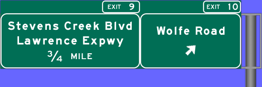
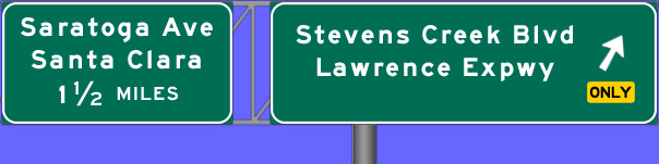
Stevens Creek Blvd is a major east-west
road connecting Cupertino and San Jose. Lawrence Expwy is
part of the county's expressway system and provides a fast route
to the companies located in Santa Clara and Sunnyvale.
|
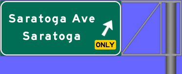 |
| Exit
7 |
South |
Saratoga Avenue connects the cities of
Saratoga and Santa Clara while passing through west San Jose. |
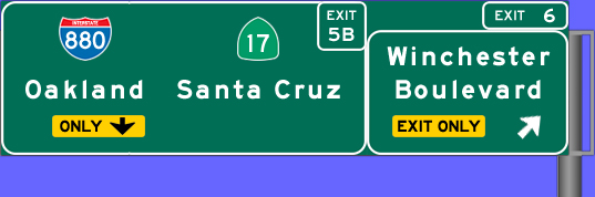 |
| Exit
6 |
South |
Use the Winchester Blvd exit from southbound
Interstate 280 to reach the Valley Fair Mall and Santana Row. During
the holiday shopping season, traffic on this ramp backs up onto
the freeway regularly. Located just north of the freeway is the
Winchester Mystery House. |
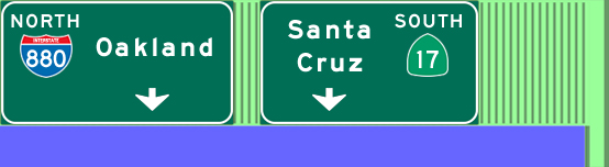 |
| Exit
5B |
South |
Highway 17 heads south from Interstate
280 through the cities of Campbell and Los Gatos before entering
the Santa Cruz Mountains on its way to the coastal city of Santa
Cruz. Interstate 880, which used to be Hwy 17, heads north to Oakland
passing through the east bay cities of Fremont, Hayward and San
Leandro. |
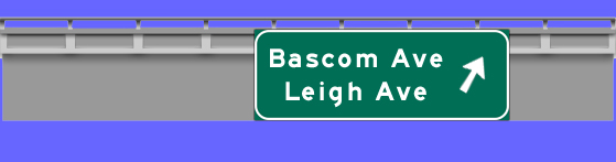 |
| Exit
5A |
South |
This exit will actually put you on Moorpark
Avenue which is a one-way street heading east with Leigh as a cross
street. You must make a left onto Leland Ave and another left onto
Parkmoor to get to Bascom Avenue. |
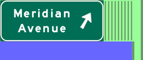 |
| Exit
4 |
South |
Meridian Avenue provides freeway access
to the Willow Glen neighborhood and the residential areas of south-central
San Jose.
|
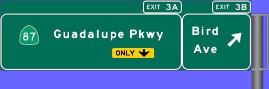 |
| Exit
3B |
South |
Bird Avenue provides access to the main
San Jose Train Station where travelers can board Caltrain or Amtrak.
This is also an alternate route to the arena. |
 |
| Exit
3A |
South |
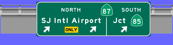
The Guadalupe Parkway/Hwy 87 is a freeway
linking the Almaden Valley to downtown San Jose and the Mineta
San Jose Intl Airport. People heading to HP Pavilion should use
this exit. |
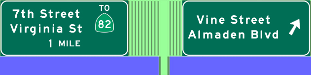 |
| Exit
2B |
South |
Before Hwy 87 was built, Vine and Alamden
were the main roads to and from south San Jose and the Almaden
Valley via Alamden Expwy. Almaden Blvd is the primary surface street
into downtown San Jose. The McHenry Convention Center can be reached
using this exit. |
 |
| Exit
22 |
South |
This is the first of two exits to get to
San Jose State University. It is also the preferred way to get
to Spartan Stadium. |
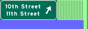 |
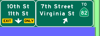
| Exit
22 |
South |
This is the second exit to get to San Jose State. 10th and 11th
Streets are both one-way north of Interstate 280 but there are
talks of converting both into two-way streets. |
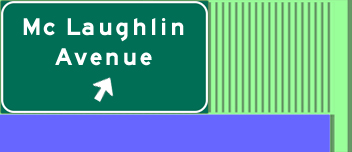 |
| Exit
22 |
South |
McLaughlin Avenue serves the residential areas east and south
of the downtown area. The neighborhoods north of the freeway are
predominately Latino while the are south is Vietnamese. |
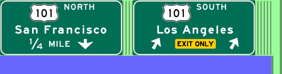 |
| Exit
22 |
South |
Heading south from here, U.S. 101 takes the scenic route to Los
Angeles along the California coast. Closer to home, U.S. 101 connects
Morgan Hill and Gilroy to San Jose. It was recently widened from
4 to 8 lanes between south San Jose and Morgan Hill. |
 |
| Exit
22 |
South |
U.S. 101 connects San Jose to San Francisco and points north including
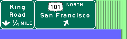
the scenic northern California, Oregon and Washington coasts. |
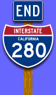 |
Intersate
280 ends after crossing U.S. 101 and becomes Interstate 680 which
travels up the east side of the valley on its way to Dublin, Walnut
Creek and Sacramento. |